Pages

Showing posts with label Pakistan Famous Places. Show all posts

Tuesday, 24 May 2011

Mansehra

Mansehra (Hindko/Urdu: مانسہرہ) city is located at  34°20′N 73°12′ECoordinates:  34°20′N 73°12′E in Mansehra District, Khyber-Pakhtunkhwa province of Pakistan. It is very near to Abbottabad city. It is a major stop for tourists on the Karakoram Highway which leads to China. It is also a major transit point to the northern areas and locations such as the Kaghan Valley, Naran, Shogran, Lake Saiful Mulook and Babusar Top.
History
The area of Mansehra has been under the rule of various emperors and governments, including Alexander the Great, Ashoka the Great, the Turks and the British Empire.
Alexander the Great conquered and established his rule over a large part of northern India, including the Mansehra area. In the year 327 B.C. Alexander handed the area over to the Indian king Abisares.
During the Maurya dynasty, Mansehra was a part of Taxila. Ashoka the Great was the governor of this area when he was a prince. After the death of his father, the Mauryan emperor Bindusara, Ashoka ascended to the throne around 272 B.C. and made this area one of the major seats of his government. The Edicts of Ashoka inscribed on three large boulders on the side of a rocky outcrop near Mansehra serve as evidence of his rule here. The Mansehra rocks record fourteen of Ashoka's edicts, presenting aspects of the emperor's dharma or righteous law, and represent the earliest irrefutable evidence of writing in South Asia. Dating to middle of the third century BC, they are written from right to left in the Kharosthi script.
The Turkish Shahi and Hindu Shahi dynasties ruled Mansehra one after another. Among the Hindu Shahi dynasty rulers, Raja Jayapala is the best known. Mahmud of Ghazni defeated him during his first Indian campaign. However, there is no historical evidence that Mahmud of Ghazni ever visited or passed through Mansehra.
After the fall of the Hindu Shahi dynasty in the 11th century, the Kashmiris took control of this area under the leadership of Kalashan (1063 to 1089). From 1112 to 1120, King Susala ruled this area. In the 12th century, Asalat Khan captured this area but soon after Mohammad of Ghor's death the Kashmiris once again regained control of Mansehra.
In 1399, the Muslim warrior Timur, on his return to Kabul, stationed his Turk soldiers in Manshera to protect the important route between Kabul and Kashmir. By 1472, Prince Shahab-ud-Din came from Kabul and established his rule over the region. Prince Shahab-ud-Din, a Turk of central Asian origin a descendant of Amir Taimur, founded the state and named it Pakhli Sarkar and chose the village of Gulibagh as his capital.
During the period of Mughal rule, local Turkish chiefs acknowledged Mughal authority. In fact, Mansehra (Pakhli) provided the main route to Kashmir and was the most commonly used route for Emperor Akbar to travel to Kashmir.
In the 18th century, Turkish rule came to an end due to the increased aggression of the Pashtuns and their allied forces. The most crucial attack was that of the Swatis in collusion with Syed Jalal Baba in 1703. Syed Jalal Shah was the son in law of the last ruler of Turkic dynasty, Sultan Mehmud Khurd.The Swatis ousted the Turks and captured this area.The descendents of this Turkic dynasty still live in various parts of Hazar, such as Bahali, Manakrai, Girwal, Mohar etc.
When Ahmad Shah Durrani expanded his kingdom to Punjab, Mansehra also came under his control. Durrani considered it wise to rule the area through local tribal chiefs. The Durranis' rule ended abruptly in the beginning of the 18th century.
The fall of the Durranis led way for the Sikhs to rise to power under Ranjit Singh. The Sikhs gained control of Mansehra in 1818, after stiff resistance from its inhabitants. When Mansehra fell under Sikh control, it was annexed to Punjab. Syed Ahmad Shaheed, with the help of the Mujahadeen, led many revolts and attacks against the Sikhs. At last, in 1831 during a fierce battle at Balakot, Syed Ahmad Shaheed was killed. This allowed the Sikhs to consolidate their control of Mansehra. After Rajit Singh's death, the Sikh empire began to disintegrate. At this time, the British gained control of Punjab, and, through this, gained control of Mansehra.
By 1849, the British had gained control of all of Mansehra. However, the western Pashtun tribes remained rebellious. Unlike the people of the settled areas, the Pukhtoon (Pathan) tribes that lived on the western outskirts of Mansehra remained a constant source of trouble for the British for four decades (1852–92). The British sent many expeditions against the Pashtun tribes to crush the rebellion, especially against the Black Mountains. To maintain peace in the area the British also took preventive measures by co-opting the local rulers.
The British divided Hazara District into three tehsils (administrative subdivisions): Mansehra, Abbottabad, and Haripur; and decided to annex it to the Punjab. In 1901, when the North West Frontier Province (NWFP) (now Khyber-Pakhtunkhwa) was formed, Hazara was separated from Punjab and made a part of it. Throughout their rule in Mansehra, the British met fierce resistance from the local Pashtun tribes and declared martial law. Meanwhile, the many villages around Mansehra largely governed themselves. Many of Mansehra's citizens joined the Khilafat Movement.
During British rule, Mansehra was still a village; its population according to the 1901 census was 5,087. During the British period Mansehra was the headquarters of Mansehra Tehsil, then a subdivision of Hazara District.
When the Muslim League in Pakistan started its movement for a separate land, the local people joined and struggled for liberation under the leadership of Quaid-i-Azam. Their eventual victory culminated in the creation of Pakistan, an independent state for the Muslims of the sub-continent.
During Bhutto's regime, Mansehra was upgraded to a district, containing two subdivisions: Mansehra and Battagram. Later, the Mansehra district had the Balakot subdivision added to it.
Literacy
Mansehra is located in a province with a literacy rate of 35.41%. In comparison, Pakistan as a whole has literacy rate of 43.92%, while Islamabad leads the nation with a 72.4% literacy rate. Hindko and Pashto are the predominant languages.
Subdivisional

The city of Mansehra is administratively divided into four Union Councils; these are:
•    Mansehra City No 1
•    Mansehra City No 2
•    Mansehra City No 3
•    Mansehra (Rural)
Each union council is divided into Mohallas.
Festival
In Durgashtami in Chetr and in Assu,at the locality of Bareri, Hindus from the vicinity, to the number of about 400, assemble at the top of Bareri hill to worship Devi and to present offerings, which are taken by a Brahmin of Mansahra.The assembly on each occasion lasts only one day. The boulders near the base of Bareri Hill are notable because they contain Ashokan inscriptions.


Don’t forget to share your comments and suggestions at below page commenting section.And if you want to post any kind of Information please email us at mazharalikhan78@gmail.com

Friday, 1 April 2011

Balochistan

Balochistan (Balochi: بلوچستان) or Baluchistan is an arid, mountainous region in the Iranian plateau in Southwest Asia; it includes part of southeastern Iran, western Pakistan, and southwestern Afghanistan. The area is named after the numerous Baloch tribes, Iranian peoples who moved into the area from the west around 1000 AD. All natives are considered Balochi even if they do not speak the Balochi language; Pashto, Hazaragi, Persian, and Brahui languages are also spoken in the region. The southern part of Balochistan is known as Makran.
The Baloch and Pashtun people constitute the two major ethnic groups; a mixed ethnic stock, mainly of Sindhi origin, forms the third major group (Sindhi Baloch). Balochistan is rich in mineral resources; it is the second major supplier of natural gas in Pakistan.
Landscape and Ecology:-
Balochistan's landscape is composed of barren, rugged mountains and fertile land. During the summer, some regions of Balochistan are the hottest. Most of the land is barren, particurarly in the Iranian and Afghan side of the region, and it is generally sparsely populated. In the south Makran lies the desert through which Alexander the Great passed with great difficulty.
Agriculture in the region is based on the cultivation of kharif or winter crops. Cultivation is often located in alluvial fans, along river-courses, and in fertile areas which are maintained through artificial irrigation systems such as qanats (holes sunk in the ground to trap water) and gabarbands (low stone and earth mounds which create raised beds which, in turn, become saturated by rainfall and water run-off from the surrounding hills). In the southern Makran and oasis region (south of the Chagai Hills) the date palm is grown and cultivated. Orange orchards are also typical in southern Balochistan, particularly Jhalawan and Sarawan.
History:-
Main articles: History of Balochistan and History of Iranian Balochistan
The earliest evidence of occupation in Balochistan is dated to the Paleolithic, represented by hunting camps and lithic scatters (chipped and flaked stone tools). The earliest settled villages in Balochistan date to the ceramic Neolithic (c. 7000-6000 BCE), including the sites of Mehrgarh (located in the Kachi Plain, east of Quetta) and Kile Gull Mohammad. These villages expanded in size during the subsequent Chalcolithic, while interaction was amplified. This involved the movement of finished goods and raw materials, including chank shell, Lapis lazuli, turquoise and ceramics. By 2500 BCE (the Bronze Age) Balochistan became part of the Harappan cultural orbit, providing key resources to the expansive settlements of the Indus river basin to the east.
From the 1st century to the 3rd century AD, the region was ruled by the Pāratarājas (lit. "Pārata Kings"), a dynasty of Indo-Scythian or Indo-Parthian kings. The dynasty of the Pāratas is thought to be identical with the Pāradas of the Mahabharata, the Puranas and other Indian sources.[1]
They are essentially known through their coins, which typically exhibit the bust of the ruler on the obverse, with long hair within a headband), and a swastika within a Brahmi legend on the reverse (usually silver coins) or Kharoshthi (usually copper coins). The coins can mainly be found in the Loralai area of modern Pakistan.
Herodotus in 650 BC describes the Paraitakenoi as a tribe ruled by Deiokes, a Persian king, in northwestern Persia (History I.101). Arrian describes how Alexander the Great encountered the Pareitakai in Bactria and Sogdiana, and had them conquered by Craterus (Anabasis Alexandrou IV). The Periplus of the Erythraean Sea (1st century AD) describes the territory of the Paradon beyond the Ommanitic region, on the coast of modern Balochistan.[2]
During the Arab conquest of the Persian empire in the 8th century, Muslim technocrats, bureaucrats, soldiers, traders, scientists, architects, teachers, theologians and sufis flocked from the rest of the Muslim world and many settled in Balochistan and its tributary state until the rise of the Mughals. Numerous Baloch tribes, an Iranian people, moved into the area from the west in the 11th century to escape the Seljuk Turks. Western Balochistan was conquered by Iran in the 19th century, and its boundary was fixed in 1872. Omani influence waned in the east and Oman's last possession, Gwadar, was bought by Pakistan in 1958. In 1998, Pakistan conducted nuclear tests in the Pakistani province of Balochistan.


Don’t forget to share your comments and suggestions at below page commenting section.And if you want to post any kind of Information please email us at mazharalikhan78@gmail.com

SINDH


Sindh(pronounced [sINDH: Sindhi: سنڌ, Urdu: سندھ) is one of the four provinces of Pakistan and historically is home to the Sindhi people. It is also locally known as the "Mehran" (مهراڻ; River). Sindhi Muslims are the largest population in the province, but other cultural, religious and ethnic groups also reside in Sindh. The neighboring regions of Sindh are Balochistan to the west and north, Punjab to the north, Gujarat and Rajasthan to the southeast and east, and the Arabian Sea to the south. The main language spoken is Sindhi. The name is derived from the Indus River that courses through it, and was known to the Assyrians (as early as the seventh century BCE) as Sinda, to the Greeks as Indos, to the Romans as Indus, to the Persians as Abisind, to the Arabs as Al-Sind, and to the Chinese as Sintow. To the Javanese the Sindhis have long been known as the Santri.
Origin of The Name:-


The Priest King from Mohenjo-daro, more than 4000 years old, located in National Museum of Pakistan, Karachi
The province of Sindh and the people inhabiting the region had been designated after the river known in ancient times as the Sindhu River, now known as the Indus River. In Sanskrit, síndhu (सिन्धु) means "river, stream", and refers to the Indus river in particular. The Greeks who conquered Sindh in 325 BC under the command of Alexander the Great rendered it as Indós, hence the modern Indus. When the British conquered South Asia in the 17th century, they expanded the term and applied the name to the entire region of South Asia and called it India.
Prehistoric Period:-
The Indus Valley civilization is the farthest visible outpost of archaeology in the abyss of prehistoric times. The prehistoric site of Kot Diji in Sindh has furnished information of high significance for the reconstruction of a connected story which pushes back the history of South Asia by at least another 200 years, from about 2500 BC. Evidence of a new element of pre-Harappan culture has been traced here. When the primitive village communities in Balochistan were still struggling against a difficult highland environment, a highly cultured people were trying to assert themselves at Kot Diji one of the most developed urban civilization of the ancient world that flourished between the 25th century BC and 1500 BC in the Indus valley sites of Moenjodaro and Harappa. The people were endowed with a high standard of art and craftsmanship and well-developed system of quasi-pictographic writing which despite ceaseless efforts still remains un-deciphered. The remarkable ruins of the beautifully planned Moenjodaro and Harappa towns, the brick buildings of the common people, roads, public baths and the covered drainage system envisage the life of a community living in a highly organized manner.
This civilisation is now identified as a possible pre-Aryan civilisation and most probably an indigenous civilization which met its downfall around the year 1700 BC. The collapse of the Indus Valley Civilization is still a hotly debated topic, and was probably caused by a massive earthquake, which dried up the Ghaggar River.
Geography and Climate:-
Main articles: Geography of Sindh and Climate of Sindh
Sindh is located on the western corner of South Asia, bordering the Iranian plateau in the west. Geographically it is the third largest province of Pakistan, stretching about 579 km from north to south and 442 km (extreme) or 281 km (average) from east to west, with an area of 140,915 square kilometres (54,408 sq mi) of Pakistani territory. Sindh is bounded by the Thar Desert to the east, the Kirthar Mountains to the west, and the Arabian Sea in the south. In the centre is a fertile plain around the Indus river.
Sindh lies in a tropical to subtropical region; it is hot in the summer and mild to warm in winter. Temperatures frequently rise above 46 °C (115 °F) between May and August, and the minimum average temperature of 2 °C (36 °F) occurs during December and January in the northern and higher elevated regions. The annual rainfall averages about seven inches, falling mainly during July and August. The southwest monsoon wind begins to blow in mid-February and continues until the end of September, whereas the cool northerly wind blows during the winter months from October to January.
Sindh lies between the two monsoons—the southwest monsoon from the Indian Ocean and the northeast or retreating monsoon, deflected towards it by the Himalayan mountains—and escapes the influence of both. The average rainfall in Sindh is only 6–7 in (15–18 cm) per year. The region's scarcity of rainfall is compensated by the inundation of the Indus twice a year, caused by the spring and summer melting of Himalayan snow and by rainfall in the monsoon season. These natural patterns have recently changed somewhat with the construction of dams and barrages on the Indus River.
Sindh is divided into three climatic regions: Siro (the upper region, centred on Jacobabad), Wicholo (the middle region, centred on Hyderabad), and Lar (the lower region, centred on Karachi). The thermal equator passes through upper Sindh, where the air is generally very dry. Central Sindh's temperatures are generally lower than those of upper Sindh but higher than those of lower Sindh. Dry hot days and cool nights are typical during the summer. Central Sindh's maximum temperature typically reaches 43–44 °C (109–111 °F). Lower Sindh has a damper and humid maritime climate affected by the southwestern winds in summer and northeastern winds in winter, with lower rainfall than Central Sindh. Lower Sindh's maximum temperature reaches about 35–38 °C (95–100 °F). In the Kirthar range at 1,800 m (5,900 ft) and higher at Gorakh Hill and other peaks in Dadu District, temperatures near freezing have been recorded and brief snowfall is received in the winters.
Flora and Fauna:-
Main articles: Fauna of Sindh and Flora of Sindh
Indus River Dolphine
The province is mostly arid with scant vegetation except for the irrigated Indus Valley. The dwarf palm, Acacia Rupestris (kher), and Tecomella undulata (lohirro) trees are typical of the western hill region. In the Indus valley, the Acacia nilotica (babul) (babbur) is the most dominant and occurs in thick forests along the Indus banks. The Azadirachta indica (neem) (nim), Zizyphys vulgaris (bir) (ber), Tamarix orientalis (jujuba lai) and Capparis aphylla (kirir) are among the more common trees.
Mango, date palms, and the more recently introduced banana, guava, orange, and chiku are the typical fruit-bearing trees. The coastal strip and the creeks abound in semi-aquatic and aquatic plants, and the inshore Indus delta islands have forests of Avicennia tomentosa (timmer) and Ceriops candolleana (chaunir) trees. Water lilies grow in abundance in the numerous lake and ponds, particularly in the lower Sindh region.
Among the wild animals, the Sindh ibex (sareh), Blackbuck, wild sheep (urial or gadh) and black bear are found in the western rocky range, where the Leopard and Asiatic Cheetah are now rare. The pirrang (large tiger cat or fishing cat) of the eastern desert region is also disappearing. Deer occur in the lower rocky plains and in the eastern region, as do the striped hyena (charakh), jackal, fox, porcupine, common gray mongoose, and hedgehog. The Sindhi phekari, ped lynx or Caracal cat, is found in some areas. In the Kirthar national park of sindh, there is a project to introduce tigers and Asian elephants.
Phartho (hog deer) and wild bear occur particularly in the central inundation belt. There are a variety of bats, lizards, and reptiles, including the cobra, lundi (viper), and the mysterious Sindh krait of the Thar region, which is supposed to suck the victim's breath in his sleep. Crocodiles are rare and inhabit only the backwaters of the Indus, eastern Nara channel and karachi backwater Besides a large variety of marine fish, the plumbeous dolphin, the beaked dolphin, rorqual or blue whale, and a variety of skates frequent the seas along the Sindh coast. The pallo (sable fish), a marine fish, ascends the Indus annually from February to April to spawn.
Although Sindh has a semi arid climate, through its coastal and riverine forests, its huge fresh water lakes and mountains and deserts, Sindh supports a large amount of varied wildlife.
Due to the semi arid climate of Sindh The left out forests support average population of jackals and snakes. The national parks established by the Government of Pakistan in collaboration with many organizations such as World Wide Fund for Nature and Sindh Wildlife Department support a huge variety of animals and birds. The Kirthar National Park in the Kirthar range spreads over more than 3000 km² of desert, stunted tree forests and a lake. The KNP supports Sindh Ibex , wild sheep (urial) and black bear along with the rare leopard. There are also occasional sightings of The Sindhi phekari, ped lynx or Caracal cat. There is a project to introduce tigers and Asian elephants too in KNP near the huge Hub dam lake.
The Indus river dolphin is among the most endangered species in Pakistan and is found in the part of the Indus river in northern Sindh. Hog deer and wild bear occur particularly in the central inundation belt. There are also varieties of bats, lizards, and reptiles, including the cobra, lundi (viper).
Some unusual sightings of Asian Cheetah occurred in 2003 near the Balochistan Border in Kirthar mountains. The pirrang (large tiger cat or fishing cat) of the eastern desert region is also disappearing. Deer occur in the lower rocky plains and in the eastern region, as do the striped hyena (charakh), jackal, fox, porcupine, common gray mongoose, and hedgehog.
Between July and November when the monsoon winds blow onshore from the ocean, giant Olive Ridley turtles lay their eggs along the seaward side. The turtles are protected species. After the mothers lay and leave them buried under the sands the SWD and WWF officials take the eggs and protect them until they are hatched to protect them from predators.
Crocodiles are rare and inhabit only the backwaters of the Indus, the eastern Nara channel and some population of Marsh crocodiles can be very easily seen in the waters of Haleji Lake near Karachi. Besides a large variety of marine fish, the plumbeous dolphin, the beaked dolphin, rorqual or blue whale, and a variety of skates frequent the seas along the Sind coast. The pallo (sable fish), though a marine fish, ascends the Indus annually from February to April to spawn. The rare Houbara Bustard also find Sindh's warm climate suitable to rest and mate.
Arrival of Islam:-
In 711 AD, Muhammad ibn Qasim led an Umayyad force of 20,000 cavalry and 5 catapults, aided by local leaders such as: Mokah Basayah, Thakore of Bhatta, Ibn Wasayo. Muhammad bin Qasim eventually defeated the Brahman Raja Dahir, and captured the cities of Alor, Multan and Debal. They built the grand city of Mansura, historically known as a vibrant Sindhi Muslim city.
Sindh became the easternmost province of the Umayyad and Abbasid Caliphate, referred to as "Al-Sindh" on Arab maps, with lands further east known as "Hind". Muhammad bin Qasim built the city of Mansura as his capital; the city then produced famous historical figures such as Abu Mashar Sindhi, Abu Ata Sindhi, Abu Raja Sindhi and Sind ibn Ali. At the port city of Debal most of the Bawarij embraced Islam and became known as Sindhi Sailors; they became famous due to their skills in: navigation, geography and languages. In fact, they inspired the One Thousand and One Nights character Sindbad the Sailor[9] ("And thence we fared on to the land of Sind, where also we bought and sold") and Sindbad-Nameh (Book of Sindbad). By the year 750 AD, Debal was second only to Basra; Sindhi sailors from the port city of Debal voyaged to Basra, Bushehr, Musqat, Aden, Kilwa, Zanzibar, Sofala, Malabar, Sri Lanka and Java, where Sindhi merchants were known as the Santri.
In the year 725, Junayad, the Abbasid Emir of Sindh, started an expedition from Nerun. He commanded a large army under the Abbasid flag, combining Arab-Sindhi cavalry. His army conquered the Temple of Somnath, and returned victorious.
Muslim geographers, historians and travelers such as al-Masudi, Ibn Hawqal, Istakhri, Ahmed ibn Sahl al-Balkhi, al-Tabari, Baladhuri, Nizami, al-Biruni, Saadi Shirazi, Ibn Battutah and Katip Çelebi[10] wrote about or visited the region, sometimes using the name "Sindh" for the entire area from the Arabian Sea to the Hindu Kush.

Don’t forget to share your comments and suggestions at below page commenting section.And if you want to post any kind of Information please email us at mazharalikhan78@gmail.com

Badshahi Mosque

The Badshahi Mosque (Urdu: بادشاھی مسجد) or the 'King's Mosque' in Lahore, commissioned by the Mughal Emperor Aurangzeb in 1671 and completed in 1673, is the second largest mosque in Pakistan and South Asia and the fifth largest mosque in the world. Epitomising the beauty, passion and grandeur of the Mughal era, it is Lahore's most famous landmark and a major tourist attraction.
Capable of accommodating 5,000 worshippers in its main prayer hall and a further 95,000 in its courtyard and porticoes, it remained the largest mosque in the world from 1673 to 1986 (a period of 313 years), when overtaken in size by the completion of the Faisal Mosque in Islamabad. Today, it remains the second largest mosque in Pakistan and South Asia and the fifth largest mosque in the world after the Masjid al-Haram (Grand Mosque) of Mecca, the Al-Masjid al-Nabawi (Prophet's Mosque) in Medina, the Hassan II Mosque in Casablanca and the Faisal Mosque in Islamabad.To appreciate its large size, the four minarets of the Badshahi Mosque are 13.9 ft (4.2 m) taller than those of the Taj Mahal and the main platform of the Taj Mahal can fit inside the 278,784 sq ft (25,899.9 m2) courtyard of the Badshahi Mosque, which is the largest mosque courtyard in the world.
In 1993, the Government of Pakistan recommended the inclusion of the Badshahi Mosque as a World Heritage Site in UNESCO's World Heritage List, where it has been included in Pakistan's Tentative List for possible nomination to the World Heritage List by UNESCO.
Construction(1671-1673):-
Construction of the Badshahi Mosque was ordered in May 1671 by the sixth Mughal Emperor, Aurangzeb, who assumed the title Alamgir (meaning "Conqueror of the World"). Construction took about two years and was completed in April 1673.[2]
The Badshahi Mosque was built opposite the Lahore Fort, emphasizing its stature in the Mughal Empire. It was constructed on a raised platform to avoid inundation from the nearby Ravi River during flooding. The Mosque's foundation and structure was constructed using bricks and compacted clay. The structure was then cladded with red sandstone tiles brought from a stone quarry near Jaipur in Rajasthan and its domes were cladded with white marble.
The construction work was carried out under the supervision of Aurangzeb's foster brother, Muzaffar Hussain (also known as Fidai Khan Koka), who was appointed Governor of Lahore by Aurangzeb in May 1671 to specifically oversee the construction of the Mosque and held that post until 1675. He was also Master of Ordnance to Aurangzeb. In conjunction with the building of the Badshahi Mosque, a new gate was built at the Lahore Fort opening into the Hazuri Bagh and facing the main entrance of the Badshahi Mosque, which was named Alamgiri Gate after Aurangzeb.
Inscribed in a marble tablet on the entrance of the Badshahi Mosque are the following words in Persian:
“The Mosque of Abul Muzaffar Muhy-ud-Din Muhammad Aurangzeb Alamgir, Victorious King, constructed and completed under the superintendence of the Humblest Servant of the Royal Household, Fidai Khan Koka, in 1084 A.H.”
Mosque Under Mughal Rule(1673- 1752):-
When it was completed in 1673, the Badshahi Mosque was not only the largest mosque in the Mughal Empire, but also the largest mosque in the world - a record it would hold for 313 years until 1986. It was also one of the largest buildings in the Mughal Empire and the world. On a clear day, it could be seen from a distance of 15 km. The Badshahi Mosque elevated Lahore to greater political, economic and cultural importance in the Mughal Empire.
Mosque Under Sikh Rule(1799- 1849):-
On 7 July 1799, the Sikh militia of the Sukerchakia chief, Ranjit Singh, took control of Lahore. After the capture of the city, the Badshahi Mosque was severely damaged when Ranjit Singh used its vast courtyard as a stable for his army's horses and its 80 hujras (small study rooms surrounding the courtyard) as quarters for his soldiers and as magazines for military stores. Ranjit Singh used the Hazuri Bagh, the enclosed garden next to the Mosque as his official royal court of audience.In 1841, during the Sikh civil war, Ranjit Singh's son, Sher Singh, used the Mosque's large minarets for placement of zamburahs or light guns, which were placed atop the minarets to bombard the supporters of the Sikh Maharani Chand Kaur taking refuge in the besieged Lahore Fort, inflicting great damage to the Fort itself. In one of these bombardments, the Fort's Diwan-e-Aam (Hall of Public Audience) was destroyed (it was subsequently rebuilt by the British but never regained its original architectural splendour).During this time, Henri De la Rouche, a French cavalry officer employed in the army of Sher Singh, used a tunnel connecting the Badshahi Mosque to the Lahore Fort to temporarily store gunpowder.
Mosque under British Rule (1858-1947):-
When the British took control of India, they continued the Sikh practice of using the Mosque and the adjoining Fort as a military garrison. The 80 cells (hujras) built into the walls surrounding the Mosque's vast courtyard on three sides were originally study rooms, which were used by the Sikhs under Ranjit Singh to house troops and military stores. The British demolished them so as to prevent them from being used for anti-British activities and rebuilt them to form open arcades or dalans, which continue to this day


Mosque's Return to Muslims and Restoration:-
Sensing increasing Muslim resentment against the use of the Mosque as a military garrison, which was continuing since Sikh Rule, the British set up the Badshahi Mosque Authority in 1852 to oversee the restoration and return of the Mosque to Muslims as a place of religious worship. From 1852 onwards, piecemeal repairs were carried out under the supervision of the Badshahi Mosque Authority. Extensive repairs commenced from 1939 onwards. The blueprint for the repairs was prepared by the architect Nawab Zen Yar Jang Bahadur. 
Mosque under Pakistan (1947-present):-
Restoration work at the Mosque continued after Lahore became part of the new Muslim State of Pakistan on 14 August 1947. By 1960, the Badshahi Mosque stood restored to its original condition at a total cost of 4.8 million rupees (1939-1960).
The Government of Pakistan established a small museum inside the Main Gateway Entrance of the Mosque. It contains relics of the Prophet Muhammad, his cousin Ali, and his daughter, Fatimah
On the occasion of the 2nd Islamic Summit held at Lahore on February 22, 1974, thirty-nine heads of Muslim states offered their Friday prayers in the Badshahi Mosque, including, among others, Zulfiqar Ali Bhutto of Pakistan, King Faisal of Saudi Arabia, Muammar Gaddafi of Libya, Yasser Arafat of the Palestine Liberation Organization and Sabah III Al-Salim Al-Sabah of Kuwait. The prayers were led by Mawlānā Abdul Qadir Azad, the then Khatib of the Mosque.[10]
In 1993, the Government of Pakistan recommended the inclusion of the Badshahi Mosque as a World Heritage Site in UNESCO's World Heritage List, where it has been included in Pakistan's Tentative List for possible nomination to the World Heritage List by UNESCO.[11]
In 2000, the marble inlay in the Main Prayer Hall was repaired. In 2008, replacement work on the red sandstone tiles on the Mosque's large courtyard commenced, using red sandstone especially imported from the original source near Jaipur, Rajasthan, India
Architecture & Design:-

The architecture and design of the Badshahi Mosque closely resembles that of the slightly smaller Jama Mosque in Delhi, India, which was built in 1648 by Aurangzeb's father and predecessor, Emperor Shah Jahan. Its design was inspired by Islamic, Persian, Central Asian and Indian influences. Like the character of its founder, the Mosque is bold, vast and majestic in its expression.

The steps leading to the Main Prayer Hall and its floor are in Sang-e-Alvi (variegated marble). The Main Prayer Hall is divided into seven sections by means of multi-foil arches supported on heavy piers, three of which bear the double domes finished externally in white marble. The remaining four sections are roofed with flat domes.

The interior of Main Prayer Hall is richly embellished with stucco tracery (Manbatkari), fresco work, and inlaid marble.

The exterior is decorated with stone carving as well as marble inlay on red sandstone, specially of lotiform motifs in bold relief. The embellishment has Indo-Greek, Central Asian and Indian architectural influence both in technique and motifs.

The skyline is furnished by beautiful ornamental merlons inlaid with marble lining adding grace to the perimeter of the mosque. In its various architectural features like the vast square courtyard, the side aisles (dalans), the four corner minarets (minars), the projecting central transept of the prayer chamber and the grand entrance gate, is summed up the history of development of mosque architecture of the Muslim world over the thousand years prior to its construction in 1673.

The north enclosure wall of the Mosque was laid close to the Ravi River bank, so a majestic gateway could not be provided on that side and, to keep the symmetry the gate had to be omitted on the south wall as well. Thus, a four Aiwan plan like the earlier Jama Mosque in Delhi, could not be replicated at the Badshahi Mosque.

The walls were built with small kiln-burnt bricks laid in kankar, lime mortar (a kind of hydraulic lime) but have a veneer of red sandstone. The steps leading to the prayer chamber and its plinth are in variegated marble.

The main prayer chamber is very deep and is divided into seven compartments by rich engraved arches carried on very heavy piers. Out of the 7 compartments, three double domes finished in marble have superb curvature, whilst the rest have curvilinear domes with a central rib in their interior and flat roof above. In the eastern front aisle, the ceiling of the compartment is flat (qalamdani) with a curved border (ghalatan) at the cornice level.

The original floor of the courtyard was laid with small kiln-burnt bricks laid in the Mussalah pattern. The present red sandstone flooring was laid during the last major refurbishhment (1939-60). Similarly, the original floor of the main prayer chamber was in cut and dressed bricks with marble and Sang-i-Abri lining forming Mussalah and was also replaced by marble Mussalah during the last major repairs.

There are only two inscriptions in the Mosque:

    * one on the main gateway entrance
    * the other of Kalimah in the prayer chamber under the main high vault.

Don’t forget to share your comments and suggestions at below page commenting section.And if you want to post any kind of Information please email us at mazharalikhan78@gmail.com

Wednesday, 30 March 2011

Clifton Karachi

Clifton (Urdu: کلفٹن ) is one of the neighbourhoods of Saddar Town in Karachi, Sindh, Pakistan.
Demographic:-
There are several ethnic groups in Clifton including Muhajirs, Punjabis, Sindhis, Kashmiris, Seraikis, Pakhtuns, Balochis, Memons, Bohras, Ismailis, Tanoli, etc. Over 99% of the population is Muslim. The population of Saddar Town is estimated to be nearly one million.
Location:-
Clifton lies in the southern area of Saddar Town. Clifton has been a residential place of the rich and famous people of Karachi since the independence of Pakistan. South of Clifton lies Clifton Beach, Pakistan's most popular beach. Many tourists or overseas Pakistanis who are visiting are often surprised to see that property prices in Clifton can be comparable to those internationally with certain residences that are spread over 2000 yards and belong to the elite, valued at around $3 million. However, due to the unofficial nature of Pakistan's property market, it is virtually impossible to support this claim with legal documentation.
Sites of Interest and landmarks:-
•    Shrine of Abdullah Shah Ghazi
•    Jehangir Kothari Parade (1922), along with the Katrak Bandstand and Lady Lloyd Pier. The Pier enabled people to walk towards the sea, but over the years the sea has retreated.
•    Bagh-e-Ibne Qasim
•    Mohatta Palace was the last residence of sisters Fatima Jinnah and Shireen Jinnah. It has now been converted into a museum.
•    Constructed in the 1970s, the Do (two) and Teen (three) Talwar (swords) monuments on main Clifton Road are important landmarks.
•    Boat Basin Park
•    Park Towers
Houses:-
•    70 Clifton is a famous residence, belonging to late Zulfiqar Ali Bhutto, President of Pakistan in the early 1970s which was later used as a sub-jail for his daughter Benazir Bhutto, who later became a prime minister of Pakistan in the late eighties and in the mid-nineties for a second time. Mir Murtaza Bhutto, the elder son of Zulfiquar Ali Bhutto, also lived there and was assassinated near the main gate of 70 Clifton Road by the police in the late 1990s.
Consulates:-
A number of consulates are located in this areas. These are:
  • Consulate of Germany
  • Consulate of Islamic Republic of Iran
  • Consulate of Italy
  • Consulate of Russia
  • Deputy High Commission of the United Kingdom
Shopping Centers:- 
Located on Teen Talwar, the Gulf Shopping Mall is one of the most famous malls of the town. People from all around the country visit this place. Here, you can find all types of things, but it mostly specializes in clothes for ladies and traditional shoes and bangles. The other shopping mall is Uzma Center which also provides and caters the same variety of items provided in the latter mall. One of the most famous is Ashiana as thhub of all exclusive clothes and you can find a great variety of clothes and materials.
Near Ashiana is Forum, a recently built modern mall of Karachi and provides an outlook on the modernization which is taking place in the country. It is a two-storey mall with offices of various companies on the top of it. Park Towers, also known as The Point, is one of the most sophisticated malls of Clifton. Opposite the shrine of Abdullah Shah Ghazi, this mall provides a range of amenities, including brand outlets, international chain restaurants, supermarkets, mobile shops, ice cream parlours and fashion line clothing shops. It is a huge mall with modern elevators and a small capsule lift. Local brands like Sputnik Footwear, Amir Adnan, Khaadi and English Boot House are present here.
Now, Clifton Road has become a commercial centre, known for its availability of high-quality goods. Wealthy people from all around Karachi and Pakistan come to shop here.
Karachi Port Trust (KPT) Underpass:-
Another addition on the main Clifton Road is the KPT underpass, which is located between the two monuments mentioned above. The underpass was completed in 2006 with the main purpose of giving drivers a non-stop pass through. It has created several problems:
•    No right turns are possible.
•    Only private vehicles are allowed to travel through the underpass; thus, those using buses or coaches suffer long, circuitous travel routes because they can not use it.
•    In the monsoon season, the underpass is often flooded.
This underpass has generated much criticism because of the way it is designed; Pakistan's leading newspapers have published articles reflecting on its turn-offs.
Places of Worship:-
The freedom of religious practice enjoyed by different sects in Karachi is demonstrated by the fact that the Ismaili Jamat Khana is on the main Schon Circle Road. There is also a rather large Hindu temple at Clifton Promenade that is quite visible thanks to its large red flag. The temple is also holy to Karachi's Sikh community, which numbers around 2000 to 3000.
My Last Words:-
Don’t forget to share your comments and suggestions at below page commenting section.And if you want to post any kind of Information please email us at mazharalikhan78@gmail.com

Minar-e-Pakistan

Minar-e-Pakistan is a tall minaret in Iqbal Park Lahore, built in commemoration of the Pakistan Resolution. The minaret reflects a blend of Mughal and modern architecture, and is constructed on the site where on March 23, 1940, seven years before the formation of Pakistan, the Muslim League passed the Pakistan Resolution (Qarardad-e-Pakistan), demanding the creation of Pakistan.[1] This was the first official declaration to establish a separate homeland for the Muslims living in the South Asia.[2] Pakistan now celebrates this day as a national holiday each year.
The monument attracts visitors from all over Pakistan, as well as the inhabitants of the Walled City of Lahore. The large public space around the monument is commonly used for political and public meetings, whereas Iqbal Park area is popular among kite-flyers.

Designe:-
The tower was designed free of cost by Nasreddin Murat-Khan,an architect/engineer hailing from Daghestan and Usman Khan an architect/engineer from Sargodha . The design approved by the President was built by Mian Abdul Khaliq and Company. The foundation stone was laid on March 23, 1960. The construction took eight years of time, and was completed in 1968. The Minar was completed on 31 October 1968 at an estimated cost of Rs. 500,000. The money was collected by imposing additional tax on the cinema and horse racing tickets on the demand of governer of west pakistan akhtar hussain. Today, the minaret provides a panoramic view to visitors who can climb up the stairs or through an elevator. The parks around the monument include marble fountains and an artificial lake.
Structure:-
The base is about 8 meters above the ground. The tower rises about 62 meters on the base, thus the total height of minaret is about 72 meters above the ground. The unfolding petals of the flower-like base are 9 meters high. The diameter of the tower is about 97.5 meters (320 feet). The base platform is shaped like a five-pointed star and encloses two crescent shaped pools. There is a central spiral staircase rising up with 162 steps. The top-dome of the minaret is made of Stainless steel inlaid with fine glass pieces.
The structure is made of reinforced concrete, stones, and marble. The rostrum is built of patterned tiles, and faces the Badshahi Mosque. The base comprises four platforms. To symbolise humble beginnings of the freedom struggle, first platform is built with uncut Taxila stones, second platform is made of hammer-dressed stones, whereas third platform is of chiselled stones. Polished white marble at the fourth and final platform depicts the success of the Pakistan Movement.[3] Mr. Mukhtar Masood a prolific writer and the then deputy commissioner of Lahore was responsible for the construction of this monument.
Inscriptions:-
At the base, there are floral inscriptions on ten converging white marble Commemorative plaques. The inscriptions include the text of Lahore Resolution in Urdu, Bengali and English, and Delhi Resolution’s text, which was passed on April 9, 1946. On different plaques, Quranic verses and 99 attributes of God are inscribed in Arabic calligraphy, whereas National Anthem of Pakistan in Urdu and Bengali, excerpts from the speeches of Muhammad Ali Jinnah, in Urdu, Bengali and English, as well as few couplets of Allama Iqbal are inscribed.[3]
The pakistan resolution is also passed in 23 march 1940 in IQBAL PARK where minar e pakistan is located in Lahore Pakistan.
Environmental Concerns:- 
With the growth of the city and location of the monument at busy intersection of Circular Road and Multan Road, air pollution from traffic-congestion is continuously damaging the marble structure which is now in need of refurbishment.
  Don’t forget to share your comments and suggestions at below page commenting section.And if you want to post any kind of Information please email us at mazharalikhan78@gmail.com

Sunday, 27 March 2011

Kaghan Valley

The Kaghan Valley (Urdu: وادی کاغان) is a valley in the north-east of Mansehra District of the Khyber-Pakhtunkhwa Province of Pakistan. It attracts many tourists from around the country. The inhabitants were affected by the earthquake disaster on 8 October 2005.
File:Glacier, Kaghan Valey.JPG
Glacier, Kaghan Valley
The Kaghan valley is named after the town of Kaghan rather than for the Kunhar River which flows through the length of the valley. The valley extends 155 km, rising from an elevation of 2,134 feet (650 m) to its highest point, the Babusar Pass, at 13,690 feet (4,170 m). Popular languages are Hindko and Gojri, while Urdu, Pakistan's national language is also familiar among the locals. The region is Alpine in geography and climate, with forests and meadows dominating the landscape below peaks that reach over 17,000 feet.
Tourism:-
Its mountains, dales, lakes, water-falls, streams and glaciers are still in a pristine state. Kaghan is at its best during summer (from May to September). In May the temperature ranges between a maximum of 11 °C (52 °F) and a minimum of 3 °C (37 °F). From the middle of July up to the end of September the road beyond Naran Valley is open right up to Babusar Pass. Movement is restricted during the monsoon and winter seasons. The Kaghan area can be reached by road via the towns of Balakot, Abbottabad and Mansehra. In Balakot, one may find buses and other transports to reach Kaghan or Naran Village.
The road from Balakot ascends along the Kunhar River through lovely forests and the villages of Paras, Shinu, Jared and Mahandri. The valley is somewhat narrow along this stretch and the views are limited but as you ascend, the surrounding peaks come into view. One spot that is quite famous for its spectacular view and scenery is 'Shogran'. This village, surrounded by peaks and forests, is east of the main Kunhar River. It hosts the famous Siri Payee Lake mountain with breathtaking views at its top.
People:-
One of the most interesting features of the Kaghan area is the Gujar (herder) families you'll see along the way bringing their animals up to the summer pastures. The Kaghan valley is one of their most popular destinations in Pakistan. You will find them camped along the road in their tents or moving up the valley with their goats, sheep and pack animals around the start of summer and on their way back to lower altitudes around the beginning of winter. this place is worth to see.

Don’t forget to share your comments and suggestions at below page commenting section.And if you want to post any kind of Information please email us at mazharalikhan78@gmail.com

Lake Saiful Muluk


Lake Saiful Muluk (Urdu: سیف الملوک) is a lake located at the northern end of the Kaghan Valley (34°52′37.34″N 73°41′37.71″E / 34.8770389°N 73.6938083°E) near Naran. It is in the north east of Mansehra District in the Khyber-Pakhtunkhwa province, Pakistan. At an altitude of 3,224 m (10,578 feet) above sea level it is amongst one of the highest lakes in Pakistan.
The lake is accessible by a 14 km road from Naran (which is accessible by a road from Mansehra via Balakot and Kaghan) during the summer months. On foot, the trek from Naran to the lake takes about 1-2 hours. The water is clear with a slight green tone. The clarity of the water comes from the multiple glaciers all around the high basin which feed the lake.
The weather here is moderate during day time while the temperature drops to minus degrees at night.
A fairy tale called Saiful Muluk, written by the famous sufi poet Mian Muhammad Bakhsh, is associated with the lake. It is the story of prince of Persia who fell in love with a fairy princess at the lake.The impact of the lake beauty is of such extent that people believe that fairies come down to lake in full moon.A poet and writer from Balakot Ahmad Hussain Mujahid wrote the story of Saiful Muluk in prose depicting the local version.
Tourism:-
The Guardian ranked Lake Saiful Muluk as the 5th Best Tourist Destination in Pakistan. Mansehra District has had a flourishing tourism industry in the past due to its many mountain ranges and the Saiful Muluk Lake, however since the 2005 earthquake the region has seen a decrease in tourists. This lake is about three thousand feet above the ground level of Naran, this beautiful lake reflects many colors in minutes.Lately there has been an interest in building hotels in the area.


Don’t forget to share your comments and suggestions at below page commenting section.And if you want to post any kind of Information please email us at mazharalikhan78@gmail.com

Naran Villiage


Naran (Urdu: ناران) is a village located in Kaghan Valley, Mansehra District of Khyber-Pakhtunkhwa province of Pakistan. The Kunhar River, swollen by glacier melt, passes through this village as it meanders its way through the valley. The village is major tourist spot. It has over 100 hotels of various types ranging from high-end luxury hotels to very low priced motels. Tent motels are also present which rent family size tents to tourists to stay in. Usually tourists stay at Naran to visit popular tourist spots nearby such as Lake Saif-ul-Malook and Lalazar.


Don’t forget to share your comments and suggestions at below page commenting section.And if you want to post any kind of Information please email us at mazharalikhan78@gmail.com

Thursday, 24 March 2011

Rawalpindi

Rawalpindi (help•info) (Urdu, Punjabi: راولپنڈی,Rāwalpindī) is a city in the Pothohar region of Pakistan in Punjab province near Pakistan's capital city of Islamabad, in the province of Punjab. Rawalpindi is the fourth largest city in Pakistan after Karachi, Lahore and Faisalabad. In the 1950s, Rawalpindi was smaller than Hyderabad and Multan, but the city's economy received a boost during the building of Islamabad (1959–1969), during which time Rawalpindi served as the national capital and its population increased from 180,000 to over 2.1 million.[citation needed] Rawalpindi is located in the Punjab province, 275 km (171 miles) to the north-west of Lahore. It is the administrative seat of the Rawalpindi District. The total area of the city is approximately 154 square kilometres (59 sq mi). Rawalpindi is the military headquarters of the Pakistani Armed Forces.
Rawalpindi, locally known as Pindi, is a bustling city strategically located between the Punjab and Azad Kashmir. Many tourists use the city as a stop before traveling towards the northern areas. Numerous shopping bazaars, parks and a cosmopolitan population attract shoppers from all over Pakistan and abroad. The city is home to several industries and factories. Islamabad's international airport, Benazir Bhutto International Airport, is actually located in Rawalpindi, and serves both cities.
History:-
Rawalpindi has been inhabitied for thousands of years, it is believed that a distinct culture flourished on this plateau as far in c1000BC. The material remains found at the site prove the existence of a Buddhist establishment contemporary to Taxila and of a Vedic civilisation. The nearby town of Taxila has another significance; according to the Guinness Book of World Records it has the world's oldest university - Takshashila University.[citation needed]
Sir Alexander Cunningham identified certain ruins on the site of the cantonment with the ancient city of Ganjipur or Gajnipur, the capital of the Bhatti tribe in the ages preceding the Christian era. Graeco-Bactrian coins, together with ancient bricks, occur over an area of 500 ha (2 mi²). Known within historical times as Fatehpur Baori, Rawalpindi fell into decay during one of the Mongol invasions in the fourteenth century.[4]
It appears that the ancient city went into oblivion as a result of the White Hun devastation. The first Muslim invader, Mahmud of Ghazni (979-1030), gave the ruined city to a Gakhar Chief, Kai Gohar. The town, however, being on an invasion route, could not prosper and remained deserted until Jhanda Khan, another Gakhar Chief, restored it and named it Rawalpindi after the village Rawal in 1493. Rawalpindi remained under the rule of the Gakkhars until Muqarrab Khan, the last Gakkhar ruler, was defeated by the Sikhs under Sardar Milka Singh in 1765. Singh invited traders from the neighbouring commercial centres of Jhelum and Shahpur to settle in the territory.[4]
Early in the nineteenth century Rawalpindi became for a time the refuge of Shah Shuja, the exiled king of Afghanistan, and of his brother Shah Zaman. The present native infantry lines mark the site of a battle fought by the Gakhars under their famous chief Sultan Mukarrab Khan in the middle of the eighteenth century. Rawalpindi was taken by Sikh ruler Maharaja Ranjit Singh in 1818. Zahid.
Queen Victoria's Statue sculpted in England was placed in the city during the rule of the British Empire, 1939
Following the British invasion of the region and their occupation of Rawalpindi in 1849, the city became a permanent garrison of the British army in 1851. In the 1880s a railway line to Rawalpindi was laid, and train service was inaugurated on 1 January 1886. The need for a railway link arose after Lord Dalhousie made Rawalpindi the headquarters of the Northern Command and the city became the largest British military garrison in British India.[citation needed]
On the introduction of British rule, Rawalpindi became the site of a cantonment and, shortly afterward, the headquarters of 2nd (Rawalpindi) Division. Its connection with the main railway system by the extension of the North-Western Railway to Peshawar immensely developed its size and commercial importance. The municipality was created in 1867.
The income and expenditure during the ten years ending 1902-3 averaged 2–1 lakhs. In 1903-4 the income and expenditure were 1-8 lakhs and 2-1 lakhs respectively. The chief item of income was octroi (1-6 lakhs); the expenditure included administration (Rs. 35,000), conservancy (Rs. 27,000), hospitals and dispensaries (Rs. 25,000), public works (Rs. 9,000), and public safety (Rs. 17,000). The cantonment, with a population in 1901 of 40,611, was the most important in all of British South Asia. It contained one battery of horse and one of field artillery, one mountain battery, one company of garrison artillery, and one ammunition column of field artillery; one regiment of British and one of Native cavalry; two of British and two of Native infantry; and two companies of sappers and miners, with a balloon section. It was the winter headquarters of the Northern Command and of the Rawalpindi military division. An arsenal was established here in 1883.
It has been recently disclosed that the British Government tested poison gas on Indian troops during a series of experiments that lasted over a decade.
In 1951, Rawalpindi saw the assassination of the first elected Prime Minister of Pakistan, Liaquat Ali Khan in Company Bagh now known as Liaquat Bagh Park (also called Liaquat Garden.) On 27 December 2007, Liaquat Bagh Park's rear gate in Rawalpindi was the site of the assassination of former Prime Minister Benazir Bhutto.[6] Her father, former Prime Minister Zulfikar Ali Bhutto was hanged in Rawalpindi in 1979.[citation needed]
The famous Murree Road has been a hot spot for various political and social events. Nala Lai, in the middle of city, history describes Nala Lai water as pure enough for drinking but now it has become polluted with the waste water from all sources including factories and houses. Kashmir Road, was renamed from Dalhousie Road, Haider road from Lawrence road, Bank Road from Edwards Road, Hospital Road from Mission Road, Jinnah Road from Nehru Road. Today Rawalpindi is the headquarters of the Pakistani Army.Few years ago it also had headquarter of Air Force.[citation needed.
Rapidly developing into a large city, Rawalpindi has many good hotels, restaurants, clubs, museums and parks, of which the largest is the Ayub National Park. Rawalpindi forms the base camp for the tourists visiting the holiday resorts and hill stations of the Galiyat area, such as Murree, Nathia Gali, Kotli, Ayubia, Rawlakot, Muzaffarabad, Bagh, Abbottabad, Samahni, Swat, Kaghan, Gilgit, Hunza, Skardu and Chitral.
The city has two main roads: the Grand Trunk Road runs roughly from east to west and is known as The Mall as it passes through the cantonment. Murree Road originates toward north from The Mall, crosses the railway lines and brushes the east end of the old city on its way to Islamabad.
The two main bazaar areas are Raja Bazaar in the old city and Saddar Bazaar, which developed as the cantonment bazaar between the old city and The Mall. Another developing market is the Commercial Market in the area of Satellite Town near Islamabad.
The crowded alleys of the old city are home to many attractions, including Hindu (in ruins now), Zoroastrian, Sikh temples and Islamic shrines. There are several museums and arts galleries such as the Lok Virsa, Pakistan Museum of Natural History,[9] and the $Idara Saqafat e Pakistan.
Rawalpindi has been a military city since colonial times and remained Army headquarters after independence in 1947. Due to this, the city is home to the Pakistan Army Museum, with displays on colonial and present day armies, armoury of historical significance and war heroes. 
Rapidly developing into a large city, Rawalpindi has many good hotels, restaurants, clubs, museums and parks, of which the largest is the Ayub National Park. Rawalpindi forms the base camp for the tourists visiting the holiday resorts and hill stations of the Galiyat area, such as Murree, Nathia Gali, Kotli, Ayubia, Rawlakot, Muzaffarabad, Bagh, Abbottabad, Samahni, Swat, Kaghan, Gilgit, Hunza, Skardu and Chitral.
The city has two main roads: the Grand Trunk Road runs roughly from east to west and is known as The Mall as it passes through the cantonment. Murree Road originates toward north from The Mall, crosses the railway lines and brushes the east end of the old city on its way to Islamabad.
The two main bazaar areas are Raja Bazaar in the old city and Saddar Bazaar, which developed as the cantonment bazaar between the old city and The Mall. Another developing market is the Commercial Market in the area of Satellite Town near Islamabad.
The crowded alleys of the old city are home to many attractions, including Hindu (in ruins now), Zoroastrian, Sikh temples and Islamic shrines. There are several museums and arts galleries such as the Lok Virsa, Pakistan Museum of Natural History,[9] and the $Idara Saqafat e Pakistan.
Rawalpindi has been a military city since colonial times and remained Army headquarters after independence in 1947. Due to this, the city is home to the Pakistan Army Museum, with displays on colonial and present day armies, armoury of historical significance and war heroes.
Pharwala Fort is about 40 km (25 mi) from Rawalpindi beyond Lehtrar road. It is a Gakhar fort built it in the 15th century on the ruins of a 10th century Hindi Shahi Fort. Emperor Babur conquered the it in 1519. Later, in 1825, Sikhs expelled Gakhars from this fort. Though in a crumbling state, it is still an attraction for castle lovers. The fort, situated in prohibited area, is only open to Pakistani visitors.
Rawalpindi has numerous sights of architectural masterpieces. A few of the heritage buildings are Purana Qil'aa (The Old Fort), Bagh Sardaran (Chief's Gardens), Haveli Sujaan Sigh (the remains of the Sikh Nawabs of Rawalpindi; the grand building has been converted into Fatima Jinnah Women University, which is the only female university established in the region).
Other ancient buildings include Jain Mandir, Jain Temple. Gordon College, a prestigious institution of high learning was set during the British Raj. The shrine of Hazrat Sakhi Shah Chan Charagh is one of the centres devotees flock to. An institution of high devotion and solace located near the famous Raja Bazar. He is the patron saint of the city and regarded as one of the two protectors of the twin cities, i.e., Islamabad and Rawalpindi, with Hazrat Bari Imam, his cousin brother.
The Rawalpindi Public Library was one of the earliest private public libraries organized after separation from India. The building was donated for a public library by the then-Deputy Commissioner Major Davis on the initiative of philanthropist Khurshid Anwar Jilani, an attorney, writer and social worker. However, the building was confiscated for election and political campaigning during the last days of Field Marshal Ayub Khan's reign, and rare manuscripts and artifacts were taken away by the influential.
Economy:-
According to the general survey of industry conducted by Directorate of Industries and Mineral Development Punjab, there are 939 industrial units operating in the district. This district is not famous for industrial goods like other districts. The progress has been mostly in the private sector. The existing industrial units provide employment to about 35,000 people, i.e., about 1.6% of district population is directly employed in large, medium and small industrial units. Apparently there is no shortage of skilled manpower. The Technical/Vocational Training Institute operating in the district turns out about 1,974 technicians/artisans annually. They are trained in engineering, air conditioning, drafting, metallurgy, welding, auto knitting and commerce, etc.[10]

•    Kohinoor Textile Mills is the largest unit in the district. It is located near Naseer Abad and is equipped with 50,000 spindles and 1,021 power looms.
•    Wattan Woolen and Hosiery Mills is fitted 10,000 spindles.
•    Rahat Woolen Mills, established in 1954, is one of the oldest and most prominent mills in Rawalpindi.
Jinnah Road, formally known as City Saddar Road, is one of the busiest business markets. It could be considered as business headquarters northern Pakistan including retailers, wholesalers, distributors, manufacturers having an approximately cash flow of more than 1 billion rupees[clarification needed] per day. The importance of Jinnah Road can be seen by the presence of more than nine banks on the road with more opening soon.
Transport:-
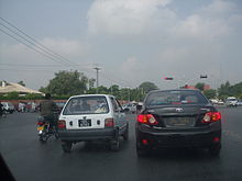
There are many ways to get in and around Rawalpindi. Public transport for travel within Rawalpindi is diverse, ranging from yellow taxis, auto-rickshaws, mini-buses and even tongas (horse-drawn carriages). Due to the lack of planning of roads, traffic jams are found even on smaller roads. For inter-city travel, air-conditioned and non air-conditioned buses and coaches are regularly available to many destinations in Pakistan. There is also an Islamabad/Rawalpindi central railway station that allows travel to every major city in Pakistan. In addition to freight, Pakistan Railways provides passenger rail service throughout the day, with train coaches that have air-conditioning in first-class.
The Rawalpindi Railway Station is located in the Saddar City. The Railway Station was built in the 1880s by the government of British India. The British built many railways across South Asia to help facilitate trade and more importantly to help consolidate their rule. The routes the British built from Rawalpindi, which contained a major military base, linked to Lahore, Karachi, Peshawar, Quetta, Multan, Faisalabad, Hyderabad, Sindh, Sukkur, Bahawalpur, Jhelum, Gujrat, Gujranwala, Kohat, Khanewal, Nawabshah, Nowshera and the Malakand Pass.
Airport:-
Benazir Bhutto International Airport is actually located at Chaklala which technically is a part of Rawalpindi. The airport is served by over 25 airlines, both national and international. Pakistan International Airlines (PIA), the national carrier of Pakistan, has numerous routes, with many domestic and international flights every day. Construction on the new Rawalpindi/Islamabad international airport has now been started near the town of Fateh Jang approx 25 kilometres (20 mi) from both cities.
The main route running through Rawalpindi is the Murree Road. This road runs West-East through the city and continues to the hill station of Murree, which is a major summer attraction for Rawalpindi residents. Murree Rd is one of the busiest roads in the Punjab Province of Pakistan.
Rawalpindi is on the ancient Grand Trunk Road (also known as G.T. Road or, more recently, N-5) which links Rawalpindi to nearly every major city in northern Pakistan, from Karachi, to Peshawar, Lahore, Quetta, Multan, Faisalabad, Hyderabad, Sukkur, Bahawalpur, Jhelum, Gujrat, Gujranwala, Kohat, Khanewal, Nawabshah, Nowshera and the Malakand Pass.
The city is also served by two nearby six-lane Motorways, M2 (Lahore-Islamabad) and M1 (Islamabad-Peshawar), which were completed in the 1990s. Somewhat further away is the famous Karakoram Highway, the world's highest international road, which connects Pakistan to China.